Tropical Storm Edouard and What It Means for Property Owners From Galveston to Port Arthur

Tropical Storm Edouard and What It Means for Property Owners From Galveston to Port Arthur

Article content

What 40 mph winds, heavy rain, and storm surge really mean for homes and businesses from Galveston to Port Arthur

Southeast Texas is watching the Gulf again. Tropical Storm Edouard, the fifth named storm of the 2026 Atlantic season, is tracking toward the upper Texas coast with maximum sustained winds around 40 mph and gusts pushing 45 to 50 mph. Landfall is expected Tuesday afternoon somewhere between Galveston and Port Arthur, and a Tropical Storm Warning, Storm Surge Watch, and Flood Watch are already in effect across Harris, Galveston, Chambers, Montgomery, and Polk counties. Edouard isn't a hurricane, and that's good news. But anyone who's lived through a few Texas storm seasons knows a storm doesn't need a category to cause real trouble. Heavy rain, a moderate surge, and tropical storm-force winds arriving together add up to a serious few days for homeowners and business owners alike.

What 40 MPH Winds Actually Can Do to a Property

It's easy to hear 40 mph and shrug. Next to the numbers a major hurricane throws around, it sounds almost gentle. In practice, sustained winds at that level, with stronger gusts layered on top, find every weak spot a building has, and they find them fast. Here's where the damage tends to show up:

  • Roofing and exterior elements, where wind lifts loose or aging shingles, breaks factory seals, and stresses tile underlayment, while soffits, fascia, and siding loosen and open hidden pathways for rain
  • Trees and debris, as gusts of 45 to 50 mph snap weak branches and send unanchored patio furniture, signage, and trash bins across yards and parking lots, sometimes into roofs, vehicles, and power lines
  • Water intrusion, which happens when wind drives rain sideways into small cracks, window seals, and lifted roofing, leading to ceiling stains, soaked insulation, and eventually mold that shows up weeks later

That last one really does deserve some real attention. The most expensive damage from a storm like Edouard is often the damage nobody sees on Wednesday morning. Water that slips in behind siding or under a lifted shingle works slowly, and by the time a stain appears on the ceiling, the problem's usually been growing for a while.

The Bigger Threat is Rain and Surge Across Southeast Texas

For all the talk about wind, rainfall is the primary hazard with Edouard. Forecasts call for widespread totals of 2 to 5 inches, with areas east of Interstate 45 and around greater Houston potentially seeing 6 to 9 inches. Anyone who remembers what a slow-moving tropical system does to Houston drainage knows exactly why that number matters. On the coast the Storm Surge Watch means water could rise as much as 5 feet above ground level in low-lying areas around Galveston Bay. When heavy inland rain and a tidal surge arrive at the same time, flash flooding follows, foundations saturate, and bayous and rivers rise faster than most people expect.

Getting Ready Before Landfall

The hours before a storm are the best time to protect yourself, both physically and on paper. Southeast Texas property owners tend to focus on a few things before the weather turns:

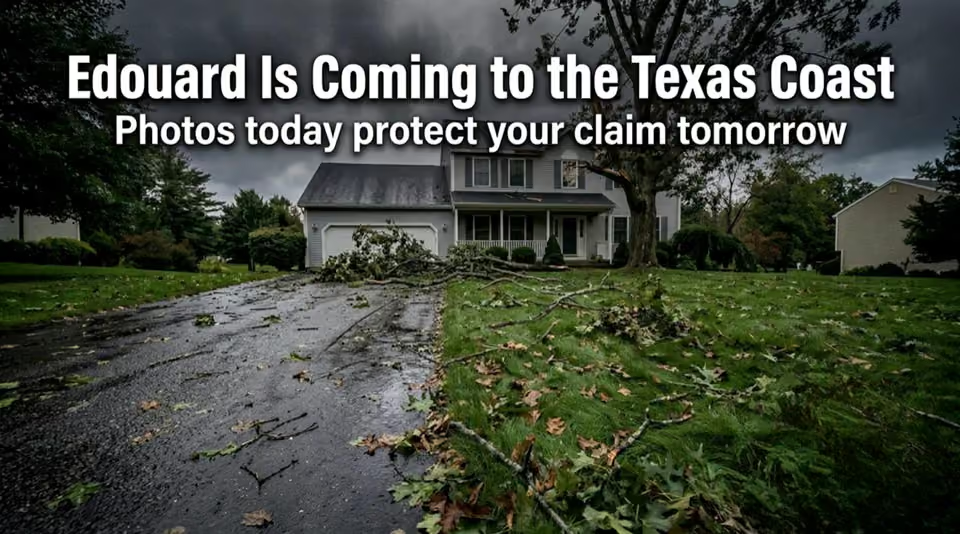
  • Photographing and videoing the property now, inside and out, so there's a clear record of its condition before the storm
  • Securing loose outdoor items, clearing drains and gutters, and moving vehicles and valuables out of areas that flood
  • Pulling up a complete copy of the insurance policy and noting deductibles, reporting timelines, and any coverage for temporary housing or business interruption

None of it's complicated but it makes an enormous difference later on. A before photo taken today can settle a lot of questions next month!

If Edouard Leaves Damage Behind

Dealing with property damage after a storm is overwhelming, and the insurance process doesn't always make it easier. People expect their insurers to step in smoothly during a crisis. Too often they run into complicated claims processes, long delays, or initial settlement offers that don't come close to covering real repair costs. Storm policies also draw fine distinctions between wind damage, wind-driven rain, and flooding, and which coverage applies can change the outcome of a claim entirely. After the storm, the same instincts apply. Document all damage before cleanup begins, take reasonable steps like tarping exposed roof sections to prevent further loss, and keep every receipt for emergency materials and services. A clear and well-documented record is the strongest thing a property owner can have when the adjuster arrives.

You Don't Have to Go Through It Alone

Whether you're protecting a single-family home in Baytown, a retail space in Beaumont, or an office building in The Woodlands, storm recovery is stressful, and the insurance side is often the hardest part. When insurers delay decisions, offer low assessments, or dispute what actually caused the damage, having experienced support in your corner changes how the process feels and how it turns out. Finman Law Group works with residential and commercial property owners throughout Southeast Texas on windstorm damage claims, helping people understand their options, challenge low estimates, and pursue the full recovery it takes to restore their property.

If Edouard damages your home or business, give us a call. We'll take a look at your situation, talk through your options, and help you figure out the next step. Stay safe out there this week.

What 40 mph winds, heavy rain, and storm surge really mean for homes and businesses from Galveston to Port Arthur

Southeast Texas is watching the Gulf again. Tropical Storm Edouard, the fifth named storm of the 2026 Atlantic season, is tracking toward the upper Texas coast with maximum sustained winds around 40 mph and gusts pushing 45 to 50 mph. Landfall is expected Tuesday afternoon somewhere between Galveston and Port Arthur, and a Tropical Storm Warning, Storm Surge Watch, and Flood Watch are already in effect across Harris, Galveston, Chambers, Montgomery, and Polk counties. Edouard isn't a hurricane, and that's good news. But anyone who's lived through a few Texas storm seasons knows a storm doesn't need a category to cause real trouble. Heavy rain, a moderate surge, and tropical storm-force winds arriving together add up to a serious few days for homeowners and business owners alike.

What 40 MPH Winds Actually Can Do to a Property

It's easy to hear 40 mph and shrug. Next to the numbers a major hurricane throws around, it sounds almost gentle. In practice, sustained winds at that level, with stronger gusts layered on top, find every weak spot a building has, and they find them fast. Here's where the damage tends to show up:

  • Roofing and exterior elements, where wind lifts loose or aging shingles, breaks factory seals, and stresses tile underlayment, while soffits, fascia, and siding loosen and open hidden pathways for rain
  • Trees and debris, as gusts of 45 to 50 mph snap weak branches and send unanchored patio furniture, signage, and trash bins across yards and parking lots, sometimes into roofs, vehicles, and power lines
  • Water intrusion, which happens when wind drives rain sideways into small cracks, window seals, and lifted roofing, leading to ceiling stains, soaked insulation, and eventually mold that shows up weeks later

That last one really does deserve some real attention. The most expensive damage from a storm like Edouard is often the damage nobody sees on Wednesday morning. Water that slips in behind siding or under a lifted shingle works slowly, and by the time a stain appears on the ceiling, the problem's usually been growing for a while.

The Bigger Threat is Rain and Surge Across Southeast Texas

For all the talk about wind, rainfall is the primary hazard with Edouard. Forecasts call for widespread totals of 2 to 5 inches, with areas east of Interstate 45 and around greater Houston potentially seeing 6 to 9 inches. Anyone who remembers what a slow-moving tropical system does to Houston drainage knows exactly why that number matters. On the coast the Storm Surge Watch means water could rise as much as 5 feet above ground level in low-lying areas around Galveston Bay. When heavy inland rain and a tidal surge arrive at the same time, flash flooding follows, foundations saturate, and bayous and rivers rise faster than most people expect.

Getting Ready Before Landfall

The hours before a storm are the best time to protect yourself, both physically and on paper. Southeast Texas property owners tend to focus on a few things before the weather turns:

  • Photographing and videoing the property now, inside and out, so there's a clear record of its condition before the storm
  • Securing loose outdoor items, clearing drains and gutters, and moving vehicles and valuables out of areas that flood
  • Pulling up a complete copy of the insurance policy and noting deductibles, reporting timelines, and any coverage for temporary housing or business interruption

None of it's complicated but it makes an enormous difference later on. A before photo taken today can settle a lot of questions next month!

If Edouard Leaves Damage Behind

Dealing with property damage after a storm is overwhelming, and the insurance process doesn't always make it easier. People expect their insurers to step in smoothly during a crisis. Too often they run into complicated claims processes, long delays, or initial settlement offers that don't come close to covering real repair costs. Storm policies also draw fine distinctions between wind damage, wind-driven rain, and flooding, and which coverage applies can change the outcome of a claim entirely. After the storm, the same instincts apply. Document all damage before cleanup begins, take reasonable steps like tarping exposed roof sections to prevent further loss, and keep every receipt for emergency materials and services. A clear and well-documented record is the strongest thing a property owner can have when the adjuster arrives.

You Don't Have to Go Through It Alone

Whether you're protecting a single-family home in Baytown, a retail space in Beaumont, or an office building in The Woodlands, storm recovery is stressful, and the insurance side is often the hardest part. When insurers delay decisions, offer low assessments, or dispute what actually caused the damage, having experienced support in your corner changes how the process feels and how it turns out. Finman Law Group works with residential and commercial property owners throughout Southeast Texas on windstorm damage claims, helping people understand their options, challenge low estimates, and pursue the full recovery it takes to restore their property.

If Edouard damages your home or business, give us a call. We'll take a look at your situation, talk through your options, and help you figure out the next step. Stay safe out there this week.

Additionally Reads

Scooter Accidents in Broward and Miami: The Risks Riders Face on South Florida Streets

Scooter Accidents in Broward and Miami: The Risks Riders Face on South Florida Streets

Scooter and Vespa accidents are rising across Broward and Miami. Learn why they happen and how Finman Law Group helps injured riders. Free evaluation.

Why Greater Houston Insurance Claims Come Back Underpaid, and What Homeowners Do Next

Why Greater Houston Insurance Claims Come Back Underpaid, and What Homeowners Do Next

Received a low insurance settlement in the Greater Houston area? Learn why underpaid claims happen, what documentation helps, and how homeowners respond.

Why Broward County Roof Damage Claims Get Denied, and What Homeowners Can Do About It

Why Broward County Roof Damage Claims Get Denied, and What Homeowners Can Do About It

Roof damage in Broward County? Learn how storm damage claims typically work, what documentation matters, and where homeowners commonly run into trouble.